Thank you to everyone who helped type up the 1891 Jurors List. It is now available to view online. If you can spare 30 minutes to type up another page, please click here for instructions.
Readers are looking for any information about:
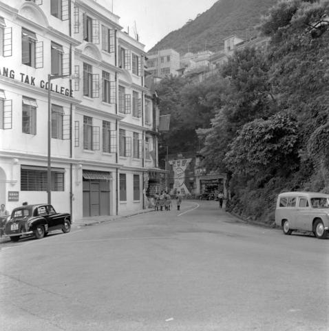
Kam Fung LAU [????-????], who bought 20 Broadwood Road during WW2
Gary Brightman of VIBE recently interviewed me for his 'VIBErations Podcast' series. You'll find this episode on Spotify and all the major podcast sites. Gary has also uploaded a copy to his Youtube channel.
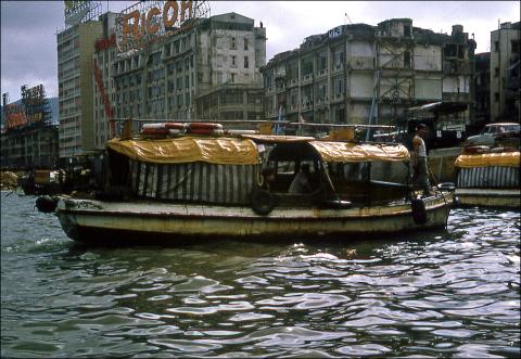
Walla Walla was the local name for a small motorboat that was available to hire, a water taxi. A common use for them was to cross the harbour between TST and Central late at night, after the Star Ferry had stopped running, but they ran in daytime too and could take you to other points around the harbour.
1966 Water Taxi (Walla Walla) off Wanchai Waterfront , by moddsey
Where does the name come from?
The usual explanation is that 'walla walla' is the sound the boat's engine made as it chugged around the harbour. But according to the late Betty Clemo, the boats were named after the city of Walla Walla in Washington State, USA.
In an RTHK interview recorded in 1970, Betty explained:
Very few people in Hong Kong know this. Years and years ago, about 55 years ago, [an American] friend of my father's called Mr Lee Nagel, came to Hong Kong. [...] He had a great idea to build motor boats to go to Kowloon - there was very little conveyance to Kowloon in those days. [...] Eventually he built six little motor boats. We went to the christening and launching, but what to call them? My father said why don't you call them your hometown's name? [Nagel] said, 'Well I come from Walla Walla, USA, let's call them Walla Walla. So they were named Walla Walla One, Two, Three, Four, Five, and Six, and that's what it started off from. And today everyone refers to them as a Walla Walla, even the Chinese do.
Update on the "Gwulo's Farewell" talk
Yesterday evening we passed 50% seats booked, so the theatres are filling up! Here are the links again:
Wed 22 May, Louis Koo Cinema, HK Arts Centre, Wanchai: Details & tickets
(The venue for 22 May is the smaller of the two and is already 90% full, so best book soon if you're planning to go to that talk.)
When were the first Walla Wallas built?
Betty remembered Lee Nagel arriving 'about 55 years ago', or in about 1915, so he'd have started his motor boat business some time after that.
A search for Walla in the old newspapers finds the first mention in July 1920. The report is of a court case involving non-payment for work done, but we also get a glimpse of Mr Nagel and his Walla Walla No. 1:
Lee Orlando Nagel, salesman employed by J. T. Shaw, Tailor, said that about the beginning of 1919 he bought a motor boat called the Tsun Wan, now Walla Walla No. 1. It was simply a wreck, needing a lot of repairs. He entered into a contract therefore with Leung Shing. The amount of the contract was $700. The boat was purchased in Causeway Bay and was left there for repair.
So it looks as though Walla Walla No. 1 was first in service sometime around 1919-20.
When did Walla Wallas disappear from the harbour?
I'm not exactly sure, though 1972 is an important year in the story of their decline. That's when the Cross Harbour Tunnel opened, and Walla Wallas suddenly faced competition from regular taxis for those late-night journeys across the harbour.
Another competitor for late-night traffic arrived in 1980, when the MTR's new tunnel beneath the harbour opened for business.
When I first arrived in Hong Kong in 1989, the guidebook I'd bought suggested Walla Wallas were still popular:
Walla-Wallas:
After the MTR closes at 1 a.m. and the Star Ferry at 11:30, you can still ride across the harbour in a small motorboat called a walla-walla (supposedly named for the hometown-Walla-Wall [sic], Washington, USA-of this craft's original owner. You can also take a taxi or bus through the cross-harbour tunnel, but if you are staying in Tsimshatsui and end up in Central-or vice versa - -the direct cross-harbour water route by Star Ferry, MTR or walla-walla is the fastest and cheapest means of transportation. On Hong Kong Island, walla-wallas are located at Queen's Pier to the East of the Star Ferry concourse (to the right as you face the harbour, in front of City Hall) while in Kowloon, they are located at Kowloon Public Pier, (to the left of the Star Ferry as you face the water, opposite the Ocean Terminal). The cost is HK$4.50 per person or HK$45 for an entire boat if you are impatient.
So after a late night out in Central when I needed to get home to TST from Central, I asked local friends about catching a Walla Walla. No-one knew what I was talking about!
I never did get to ride in a Walla Walla. Instead if we needed to cross the harbour late at night, the choice was either a taxi or a white-knuckle ride in a red minibus.
Do readers know if there was ever a clear end to the Walla Wallas' service, e.g. because of some change in licensing? Or did they just become uneconomic to run, and gradually fade away?
And if you have any memories of the Walla Wallas you can share, please leave a comment below or upload a photo.
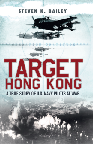
The new book, Target Hong Kong: A True Story of U.S. Navy Pilots at War by regular contributor Steven K Bailey (ssuni86 on Gwulo), is now available. "Target Hong Kong describes the U.S. Navy’s ambitious but flawed attempt to bomb Hong Kong during Operation Gratitude, which involved nearly 100 warships and close to a thousand carrier-based warplanes." Read more ...
Tickets are selling steadily for the Gwulo's Farewell talks on the 8th & 22nd of May - by Friday one quarter of the seats were already filled. You can book tickets via the EventBrite website.
We're the subject of the next video interview from Bristol University's Hong Kong History Centre, Video #5: David Bellis, Gwulo.com. It has had a good reception so far, with over 16,000 views.
I've edited the automatic subtitles to the recent talk, Who in these 1880s-1950s photos called Hong Kong 'home'?, to correct some mistakes and make them easier to read. You can see the updated video & subtitles on Youtube.
Thank you to everyone who came along to my recent talk at the USRC showing Hong Kong photos with a military connection, and to the Orders & Medals Research Society (OMRS) for arranging it. You can read their write-up of the event on the OMRS website.
The big change for the Bellis family in 2024 will be our move in July, leaving Hong Kong to go and live in the UK. Here's a look at how that affects this year's plans for Gwulo.
Summary:
First half of 2024
Farewell talk
Upgrade the website software
Relocate to the UK
Second half of 2024
Will there be any effects on the Gwulo website?
London talk
Medium term
New website features
Try videos
Long term
Passing on the baton
Keeping the data safe
1. FIRST HALF OF 2024
1.1 Farewell talk
Before we leave I'd like to give one last talk, looking at some of the highlights since I posted my first page about Hong Kong's history back in 2006.
I'll show some of my favourite photos and tell their tales, and we'll revisit some of the other stories which Gwulo has been involved with that I've found most memorable. I'll also take us on a quick whistle-stop tour of how the website has changed over the years.
We've booked two theatres that have sharp projectors and tiered seating, so that everyone gets a clear view of the photos:
8 May, 7:30 pm - Lecture hall, HK Science Museum, TST - $150 / $75 - Book tickets
22 May, 8 pm - Louis Koo Cinema, HK Arts Centre, Wanchai - $200 / $100 - Book tickets
As the Science Museum's lecture hall seats well over 200, and the Louis Koo Cinema seats over 100, I'm a bit nervous they'll look empty! Please help fill them up by letting any friends who are interested in Hong Kong history know about this talk.