Skip to main content
Menu
Menu
Home
Free newsletter
Shop
Explore
Add new...
What's new
FAQs
About
Gwulo menu for header
Show — Gwulo menu for header
Hide — Gwulo menu for header
Home
What's new
Gwulo
Old Hong Kong
Photos tagged:
map
Primary tabs
View
Books
Events
Organisations
Pages
People
Photos
Places (map)
Places (list)
Streets (map)
Timelines
Items per page
25
100
- All -
Year
Title
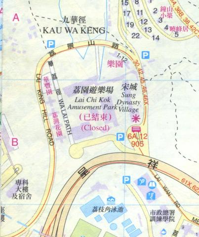
1997
1997 map of Lai Chi Kok
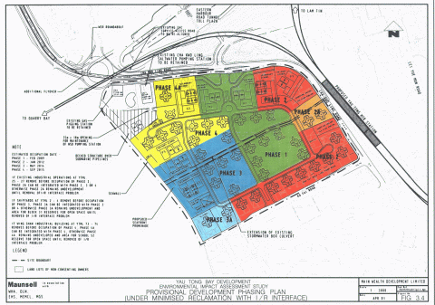
c.1998
Proposal for the Yau Tong Bay reclamation 1998
1990s
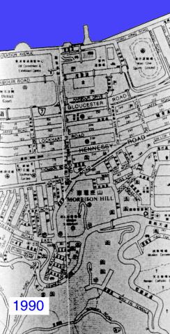
Wanchai 1990
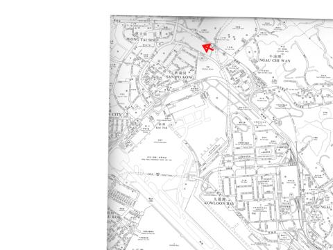
1990s
Kai Tak airport area
1990s
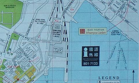
Map of Hung Hom Bay about 1990
c.2003
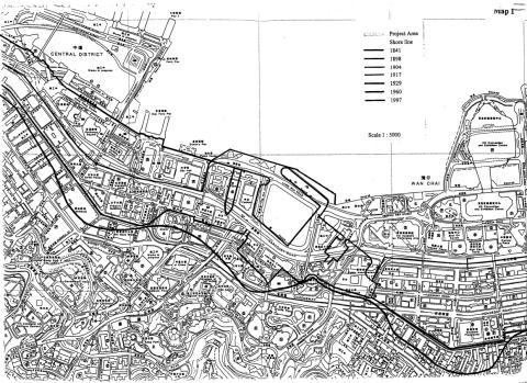
Map Central Wanchai c. 2003
2010
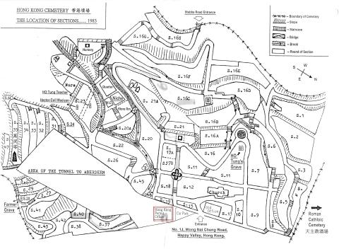
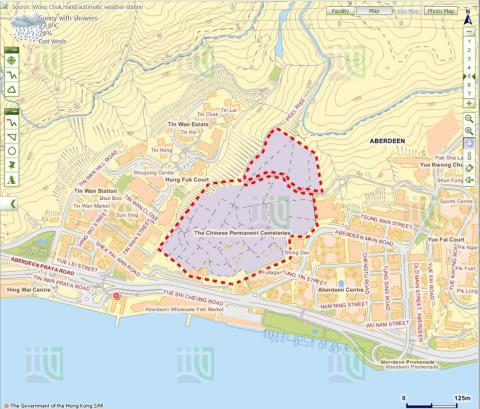
Hong Kong Cemetery Map
2011
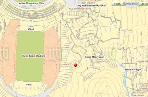
Wesley Village and Race Course Fire Memorial
2011
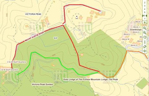
Map of Victoria Peak
2011
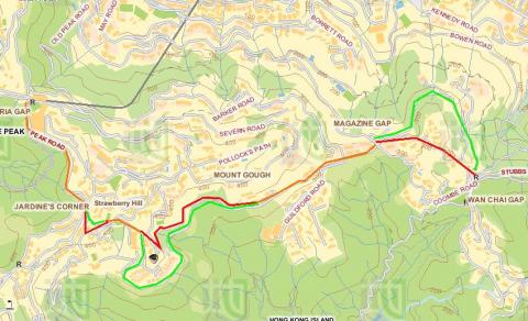
Route from Upper Peak Tram Terminus to Wanchai Gap
2013
2013 map of lower Shing Mun reservoir
2014
Map of area around Central Police Station
2014
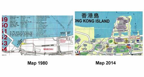
Maps Fenwick Pier 1980_2014
2015
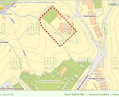
Haystack - RBL 509
2015
AIL 78
2015
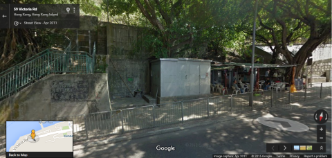
A bend on Victoria Road
2015
A bend on Victoria Road and Sai Ning Street Garden
2015
Map
2015
'Shed' which the city boundary of Victoria cuts through on Victoria Road
2015
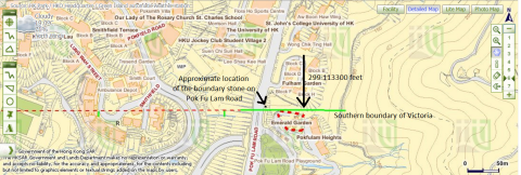
The University of Hong Kong's St John's College and Victoria's southern boundary
2015
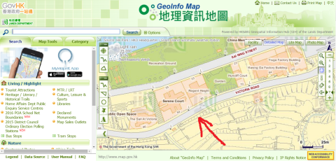
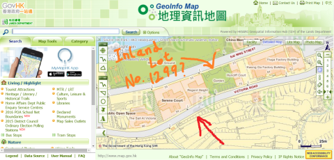
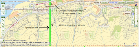
Victoria's western boundary cuts through Serene Court.png
2015
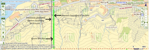
Western boundary of Victoria and previosuly-predicted location of the boundary
2015
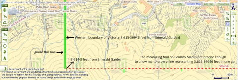
3,615·36946ft from Emerald Garden
2015
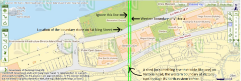
City boundary of Victoria intersects Victoria Road and Sai Ning Street
2015
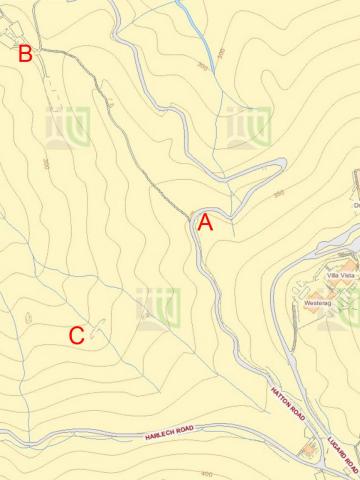
Lines drawn to deduce the location of Victoria's western boundary
Pagination
First page
« First
Previous page
‹‹
…
Page
18
Page
19
Page
20
Page
21
Page
22
…
Next page
››
Last page
Last »