Skip to main content
Menu
Menu
Home
Free newsletter
Shop
Explore
Add new...
What's new
FAQs
About
Gwulo menu for header
Show — Gwulo menu for header
Hide — Gwulo menu for header
Home
What's new
Gwulo
Old Hong Kong
Recent photos
These are the photos most recently added to the Gwulo website.
Items per page
25
100
- All -
Title
Year
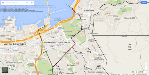
Map of Causeway Bay District, Victoria, Hong Kong
2015
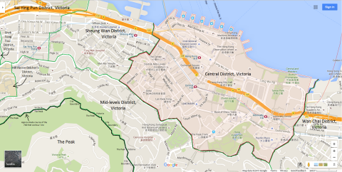
Map of Central District, Victoria, Hong Kong
2015
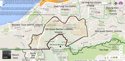
Map of Hill Above Belcher's District, Victoria, Hong Kong
2015
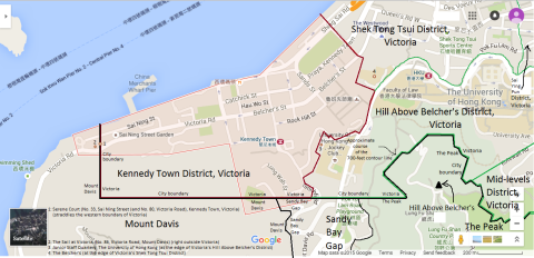
Map of Kennedy Town District, Victoria, Hong Kong
2015
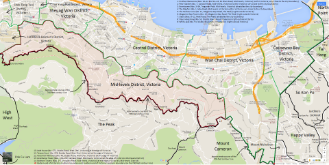
Map of Mid-levels District, Victoria, Hong Kong
2015
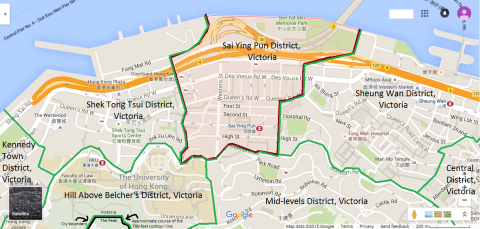
Map of Sai Ying Pun District, Victoria, Hong Kong
2015
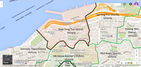
Map of Shek Tong Tsui District, Victoria, Hong Kong
2015
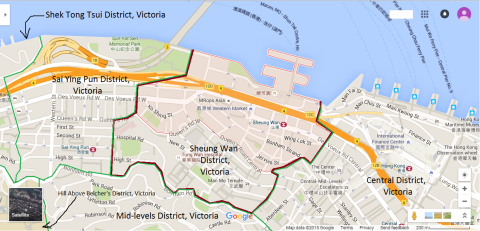
Map of Sheung Wan District, Victoria, Hong Kong
2015
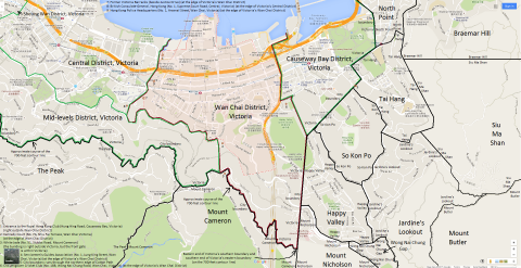
Map of Wan Chai District, Victoria, Hong Kong
2015
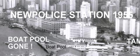
Police Station built 1955
1966
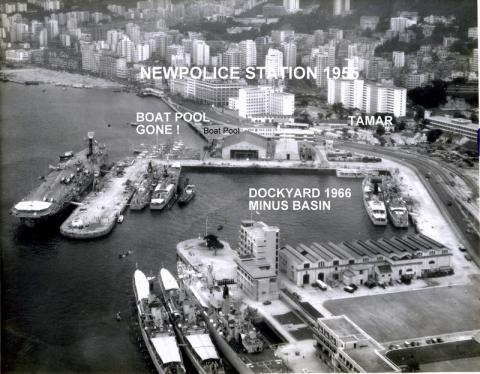
Police Station and environs 1966
1966
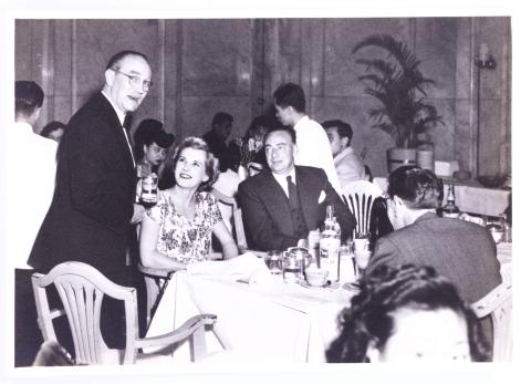
130_People_Cloak_Room_Ground_Floor_HongKong_Hotel.jpg
1950
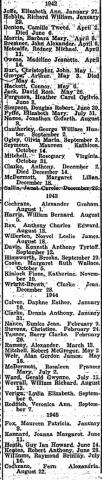
1942-1945 Births at Stanley Internment Camp
1945
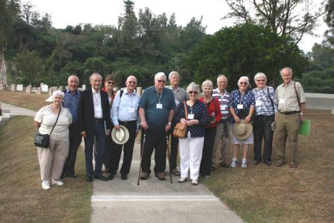
Stanley Camp reunion, December 2015
2015
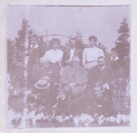
191_People.jpg
1900s
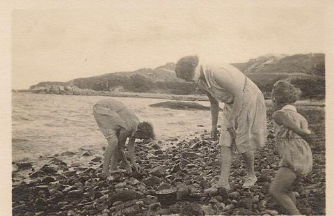
Stonybeach:StanleyBeach.jpg
1929
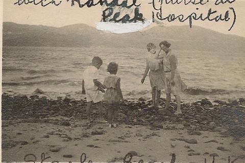
Stanley beach Nurse Randal.JPG
1929
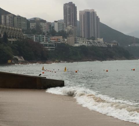
View from Stanley Main Beach
2015
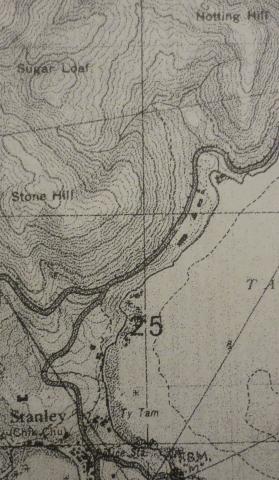
1939 OS Map of Stanley Main Beach
1939
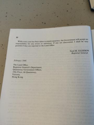
Preface to Index of Streets, House Numbers and Lots in Hong Kong, Kowloon and New Kowloon for 1987 (part 2 of 2)
2015
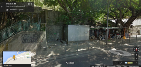
'Shed' which the city boundary of Victoria cuts through on Victoria Road
2015
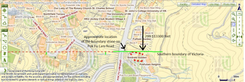
The University of Hong Kong's St John's College and Victoria's southern boundary
2015
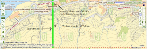
Victoria's western boundary cuts through Serene Court.png
2015
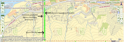
Western boundary of Victoria and previosuly-predicted location of the boundary
2015
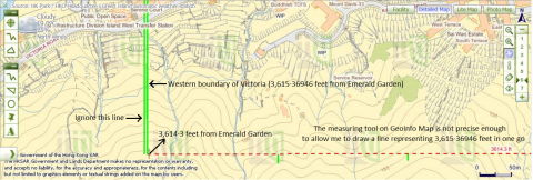
3,615·36946ft from Emerald Garden
2015
Pagination
First page
« First
Previous page
‹‹
…
Page
1109
Page
1110
Page
1111
Page
1112
Page
1113
…
Next page
››
Last page
Last »