The estate, informally called Tai Wan Shan Resettlement Estate (Chinese: 大環山徙置區) or Tai Wan Shan Estate (Chinese: 大環山邨), was a resettlement estate built in Tai Wan Shan, a hill in Hung Hom area. It had four 7-storey blocks completed in 1956. All four blocks were demolished for redevelopment in 1996 and 2000. Completed in 1999, redevelopment phase 1 project consists of two residential buildings built in the former site of Block 3 and 4. Redevelopment phase 2, finished in 2011, consists of three more 40-storey buildings on the former site of Block 1 and Block 2. It was renamed Hung Hom Estate. (note the predecessor of Ka Wai Chuen also called Hung Hom Estate)
https://en.wikipedia.org/wiki/Hung_Hom_Estate
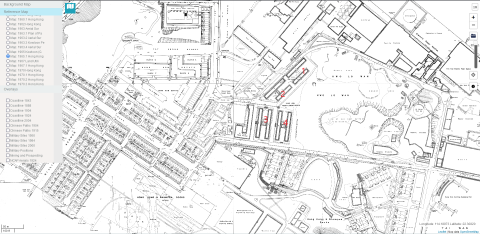
A 1965 map showing the 4 blocks.
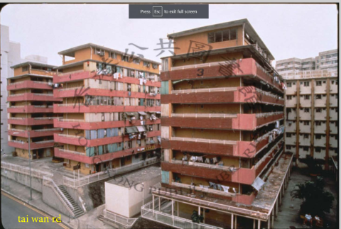
This 1994 photo shows block 3 and block 4 looking south from Tai Wan rd. The top of new Whampoa Estate (built 1976-1978) can be seen behind Tai Wan Shan Estate.
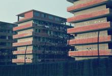
The following photo looking north along Tai Wan Rd with block 1 and 2 on the right side of road.
Photos that show this Place
Comments
1960s 1970s tai wan rd
That neighborhood seen from Tai wan rd.
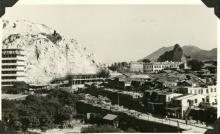
1960s looking south and east :
Tai Wan rd and Green island cement work at bottom.
On the left the Holy Carpenter Prevocational School 聖匠職業訓練學校 established in 1965. Renamed SKH Holy Carpenter secondary school in 2002 which still exists today. Further left and behind it is the St Marys church. We can also see the crane of Whampoa dockyard. At the top left corner roof of block 3 of Tai Wan Shan estate. (see 1965 map https://gwulo.com/media/46815). On the right a square with a lot of squatter hut businesses and also a factory. There are trucks unloading goods.
A 1968 areal picture shows how that area looked like:
https://gwulo.com/media/41027/zoom
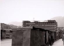
Similar picture in 1970s looking south and east :
The only change seems to be the New Whampoa estate (1976-1978) south of Tai Wan rd.