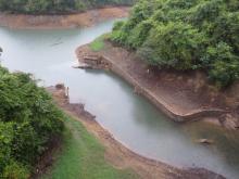
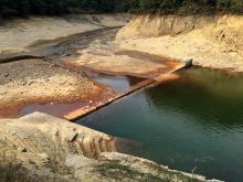
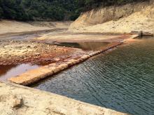
Submitted by gw on Sat, 03/18/2017 - 14:07 Current condition Ruin Date completed 1 Nov 1903 (Day is approximate.) Tags Tai Tam Tuk Reservoir water supply Log in or register to post comments Photos that show this Place 2014 2017 2017 See more photos of this place Comments Old Dam at Tai Tam see comments at https://gwulo.com/media/17877 dated 18-3-2017. Log in or register to post comments
Old Dam at Tai Tam see comments at https://gwulo.com/media/17877 dated 18-3-2017. Log in or register to post comments
Comments
Old Dam at Tai Tam
see comments at https://gwulo.com/media/17877 dated 18-3-2017.