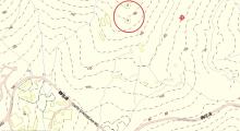
Current condition
Ruin
Date completed
(Day is approximate.)
Year completed is: Accurate
Condition at last visit: Ruin
Date of last visit: Apr-1998, 2014.
Ref: ROB-00113
Other:
Timeline:
- 1939: Constructed as an Emergency Bty, completed in July. (ADM 116/4356).
- 1939: Armament: 2 x 4" BL Naval guns. (ADM 116/4356).
- 1941: 2 x 4" BL Naval guns. Destroyed by crew on withdrawal 19th December. (WO 172/1687).
- 1945: No guns remain. (WO 78/750A).
- 2014: Some ruins remain, heavily overgrown.
For a background to these notes, and a glossary of terms used, please see: http://gwulo.com/node/24630

Comments
D'Aguilar Battery and Bokhara Battery
Hello everyone:
I found it difficult to find information about D'Aguilar Battery and Bokhara Battery (perhaps I couldn't find the right way). I am very happy to find a lot of rare military ruins information on Gwulo Map of all Places. But please forgive me for being frank, the information here about the above two Batteries is not complete, and some of the information about D'Aguilar Battery is inaccurate. For example:
The location shown in BOP1 does not belong to the accompanying photo (the building in the photo should be above Upper Gun Emplacement)
The photo attached to BPR does not match the location indicated, and the photo should belong to that labeled as D'Aguilar FOP East & West on the map...
Please understand that I am pointing out the above questionable areas, not malicious criticism, but sincerely hope that this webpage can be better.
In addition, there are many suspected military building ruins within the scope of D'Aguilar Battery that have not been marked or even displayed on the map.
I found two videos about Cape D'Aguilar on YouTube:
https://youtu.be/-1W00-f9MTY
https://youtu.be/wAsgvpZcmto
The producer visited most of the affiliated buildings related to these two Batteries. Unfortunately, many of the buildings that appeared were not identified. For example:
In video Part I
12:30-What is the low wall building outside FOP, not shown on map.
13:03-The same low wall building has many "tiles" on the ground, shown on map
13:19-Unknown building, shown on map
14:10-Unknown building, shown on map
14:21-The same low wall building has many "tiles" on the ground, shown on map
14:39-The same low wall building has many "tiles" on the ground, shown on map
14:56-The same low wall building, is overgrown, shown on map.
15:46-Not shown on map, is this an ammunition storage for Lower Gun Emplacement?
17:26-Unknown building, not shown on map
17:59-Unknown building, not shown on map
18:02-Unknown building, not shown on map
18:24-Not shown on map, is this an ammunition storage for Upper Gun Emplacement?
19:05-This should be BOP of D'Aguilar Battery
19:45-Is this an openair observation point?
In video Part II
3:35-Unknown building, marked on map
3:48-Unknown building, marked on map (seems to be a toilet)
4:48-What does "LSO and 25.9.53" mean engraved on this stone sill?
5:04-Is this a powder magazine for Gun Emplacement?
6:08-Unknown building, not marked on map
6:18-Unknown building, not marked on map
The recent condition of DEL 1 that has never been seen before appeared at 7:26 in the video.
DEL 2 appeared at 18:48 in the video. Is the cabin at 18:20 a military building?
I really hope that someone can identify and share information about these buildings mentioned above so that information about Cape D'Aguilar area on this webpage can be more complete.
Thank you!
p.s. The videos are narrated in Cantonese and only has Chinese subtitles.