Current condition
Unknown
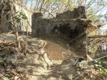
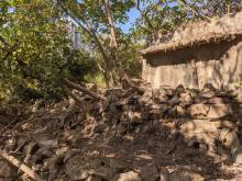
Found this concrete structure right next to the gate to the base of the service reservoir. The roof is gone. I remember I read some article mentioning the defenders blew up the battery structures before they retreat.
On the slope atop the structure above I found this:
It looks like some foundation of a wall or a terrace. Let's see some thing closer:
There is also something odd at the top of the hill. There are five (5) trigonometrical stations up there. I believe you folks should be able to spot those five from Google Earth if you zoom it right.


Comments
View towards Lama Island
When I return to this location earlier today, I went to the edge and took these photos and combined them in this:
I don't think the trees were around back in 1941 so the view angle should be much wider. I am convinced the upper battery was behind me somewhere. But it is no longer there.
T
Another low wall.....
Slightly up the slope above the ruins there is another low wall. This one is quite long, skirting the the fence at the base of the service reservoir﹕
This is the other end:
I believe it is at least 25 metres long. Comparing today's satallite image with the 1964 aerial photos might give us some idea of the approximate location of some of the ruins.
T
Battery Observation Post
This structure is mentioned in the 1941 Defence Scheme as the Battery Observation Post for Fort Aberdeen, which is the platform a bit further down the hill. Most of the roof has collapsed and the interior is filled with rubbish, though a local resident appears to be now using it as a place to grow their plants.