Current condition
In use
This is where Booth says the 'Queen of Kowloon' lived in a cock-loft. Some mad old lady - rumours were that she was Princess Anastasia. The photo below is looking west and you can see the two yellow-striped CUHK high-rises in the background - sandwiched between these on the ground level is the Kwun Yam Temple. 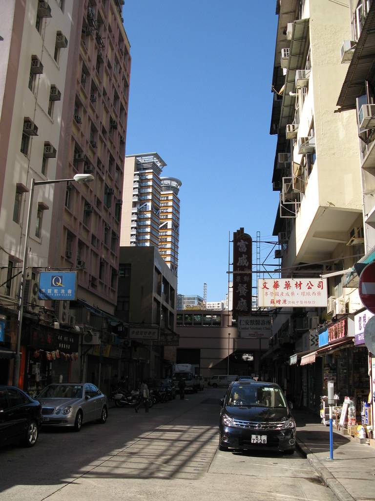
The photo below is another one at the western end of Liberty Avenue and was the oldest building I could find in the area. I have no idea if it would have been built in the 50's?

Comments
The Queen of Kowloon's building
Just signed up to answer the above; I'm reading Martin Booth's book for the first time, and just started this chapter. (Thanks so much to everybody at Gwulo who's making the book an even richer experience with all the historical info and photos).
You can find out ages of buildings in the mapping website Centamap.com (hope it's ok to give out the URL, I have no connection to them except as an end-user).
From their information, I can tell you that none of the buildings on Liberty, Victory, or Peace Avenues dates back *quite* as far as The Queen's first appearance in the book, from 1952. There is one building in the immediate area that just reaches back far enough to have been there, although it would've been brand new at the time. 27 Soares Ave has an occupation date of April 1952.
The building in the photo above would, I believe, be 1B and 1C Liberty Ave. That has an occupation date of August 1955, as does the adjacent 6A / 6B Peace Ave. Most of the remaining buildings in the triangle between Argyle St, Waterloo Rd, and Peace Ave date to 1957-67, with a few dating to the 70s, 80s, and 90s.
Liberty Ave
Hi, thanks for the info. I must admit since this was all done (3 years ago) Google introduced streetview and so running around to all these places to get snaps has become 'virtually' much easier :-)
Having said that I can't find anything on Liberty Ave (via SV) that looks as interesting as the one I snapped above and it's nice to know that it is almost from that era.
Can you take me through the centamap building date process? I am sure everyone here would find it useful. I have been using the R & V Dept "Names of Buildings" document for most of my date research. It's useful but being in PDF form means you need to know at least some element of the name/address to remove the need for scrolling through lots of text written pages.
Many thanks
Phil
i love this area of kowloon,
i love this area of kowloon, reminds me of being a kid and hanging out far too much at the fourseas bowl (previously fourseas hotel - now metropark). i used to cut across either soares or emma aves to get to argyle - on one of them there was a durian wholesaler so avoided that one when in season. right at the bottom of this range of buildings was peace ave where my mother's garage was, car in there a few times with bumps and bruises ;)
Finding building dates with Centamap
Hi Phil
Glad to help! The process is fairly simple, although you do have to work around a slight Centamap bug introduced a year or two ago, unless you can read Chinese. (I can't, but figured it out with judicious use of cut'n'paste and Google Translate).
Hope that helps! :-)
Centamap
I've tried it but keep getting a runtime error on the left hand side when I hit the Property Market > Building Information link (the other links seem to work fine e.g Property Listing, CIS Listing etc)
However, when I can get it working it looks to be a fairly handy tool. Many thanks for taking the time to share.
Cheers, Phil
[edit: I originally tried with Firefox V6.0.2 and had problems but have since tried with Google Chrome and it works fine with that :-) ]
Liberty Ave
Hi Vanessa
I'm amazed at how quiet the place can still get, even at the weekends. It seems to be far enough away from the main roads to make quite a nice stroll with some interesting places to see.
Cheers, Phil
Liberty Ave.
Hi Phil,
I don't have a history in this area, although I do work close by nowadays and occasionally go down there to have lunch (Victory Ave. has a number of nice eateries). I can say with some confidence that this area is more busy on weekdays because of the large number of secondary school students that lunch there. On weekends, it gets quiet as the cohort stays home. As others in this thread has mentioned, this area feels kind of aged but not as aged as the Queen obviously. Aside from that, Victory and Peace Aves. have lots of pet shops, and I do watch my step to avoid dirtying my shoes.
breskvar
Naming for End of WWII?
I guess these three streets at Ho Man Tin: Peace Avenue 太平道, Victory Avenue 勝利道, Liberty Avenue 自由道 are named for the end of WWII.
Victory, Peace and Liberty Avenues
As I understand, the captioned roads were named to commemorate the end of WWI. During this period there were plans for Argyle St to be extended to Kowloon City.
See Phil's comments here
lolau,
http://gwulo.com/node/2424
breskvar
Victory Ave
Hi Breskvar - thanks for letting me know. I think the times I have been here coincided with the kids still in their lessons. Worth remembering if you want a more peaceful stroll. My next trip will be to try some of your eateries on Victory Ave :-)
Cheers,
Phil
Peace Avenue
Looking at a 1924 map of this area, I note that Peace Avenue was originally named Foch Avenue.
Is anyone aware when the name was changed to Peace Avenue?
Peace/Foch
Hi there,
It seems that the 1924 map probably used old information. In the 1920 Jurors' list somebody was already mentioned as living in Peace Avenue (http://gwulo.com/jurors-list-1920). The 1921 list even gave the district, and Peace Avenue was in Homantin (http://gwulo.com/jurors-list-1921).
As well, according the Phil, that plot of land was developed after WWI with Liberty, Victory and Peace Avenues to commemorate the war (http://gwulo.com/node/2424). Very likely any road built before the early 1920s was named Foch and then renamed Peace Avenue as it was developed.
breskvar