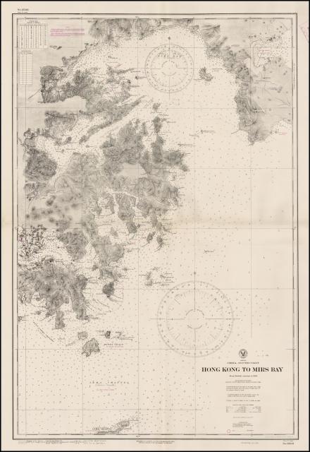
I put the link to this hydrographical sea chart on the thread connected with Plover Bay. However I thought it deserves an image in its own right on Gwulo as the names are so evocative, e.g. Crooked Harbour, Port Shelter, Rocky Hanrbour and the Nine Pin Group of islands, and I'm not sure if they still exist. There's also a nice little glossary of Chinese to English geographical terms. From the information given, I believe the chart was from the 1906 British Survey but not printed till 1912 and then reissued by the US during World War 2. It is described as a hydrographical sea chart of the eastern approach to Hong Kong Harbour. Some of the names describe the location of photographs taken by W.R. Fell while patrolling for pirates in the region with the 4th Submarine Flotilla in the late 1920s.
Comments
This map shows many of the
This map shows many of the navigational beacons/lighthouses marked with magenta dots (e.g. Cape D'Aguilar Lighthouse [1875- ]). Suggest to add the tags "navigational beacon" and "map" for helpful links to related entries.