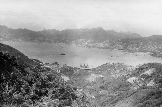
I think that this could have been taken from the road that runs up the valley from Quarry Bay to Sanatorium Gap between Mt Parker and Mt Butler. The Tai Koo dockyard cranes can be seen in the centre and it is just possible to make out one of the original runways at Kai Tak. (Andrew S)
Date picture taken
1953
Gallery
Shows place(s)
Comments
Zoomed features
Zooming brings up several features mentioned elsewhere on Gwulo. The ship left centre looks like a C.N.Co. vessel. Left of the cranes is Stanley Terrace, and further west the Taikoo Sugar Refinery. S.W. of these is "Woodside".
Moving east: Taikoo's Quarry Bay local staff village and the "Back" dam; then The Bungalow and "Bungalow" dam. Kornhill West and East are on the end of the ridge east of the cranes.
Bottom right of centre is one of the WW II emergency "Soup kitchens".
Thanks for the additional
Thanks for the additional information. Andrew