Skip to main content
Menu
Menu
Home
Free newsletter
Shop
Explore
Add new...
What's new
FAQs
About
Gwulo menu for header
Show — Gwulo menu for header
Hide — Gwulo menu for header
Home
What's new
Gwulo
Old Hong Kong
Recent photos
These are the photos most recently added to the Gwulo website.
Items per page
25
100
- All -
Title
Year
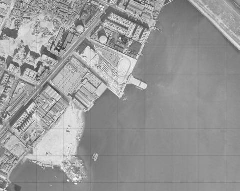
To Kwa Wan Aerial Photograph 1963
1963
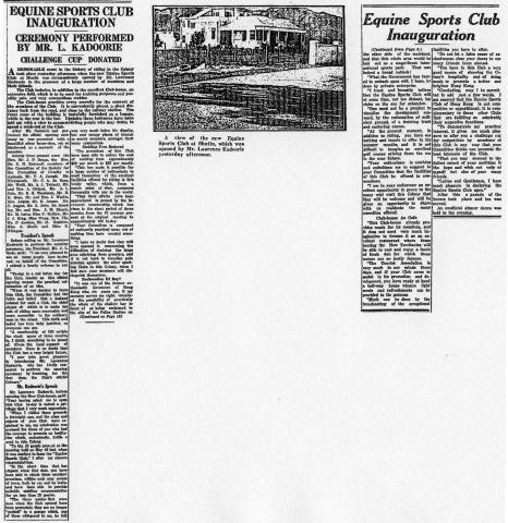
EQUINE SPORTS CLUB OPENED IN SHATIN
1935
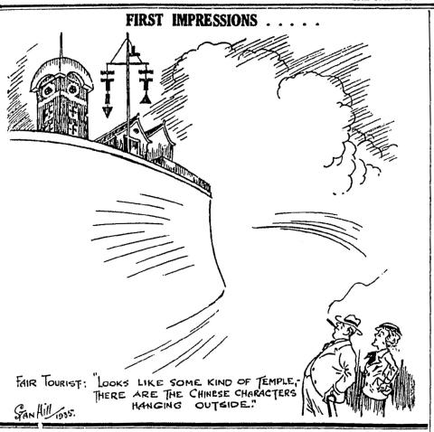
BLACKHEAD POINT - Signal Hill - First impressions - HK Sunday Herald
1935
HKRS913-1-360.jpg
1950s
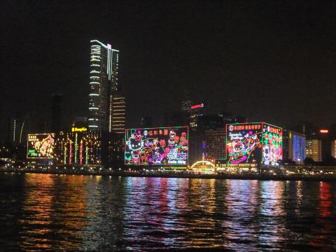
TST waterfront with neon lights
2014
1950s Hysan Avenue
1952
View 1 William Batley. Ivy's father.jpg
????
OliveBatleyivy sister.jpg
1940s
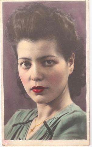
ivy.jpg
1940s
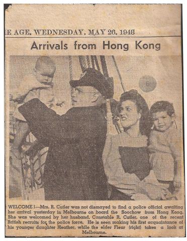
ivy newspaper.jpg
1948
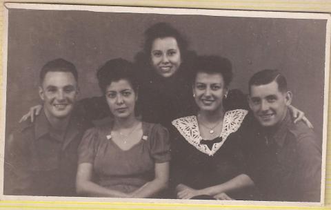
Ivy olive mary batley .jpg
1940s
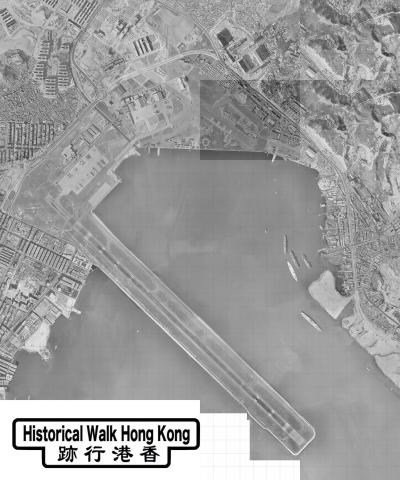
KaiTak Plan 1963
1963
永樂戲院 photo.png
1968
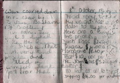
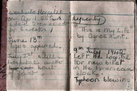
pages 7-8 cropped.jpg
1942
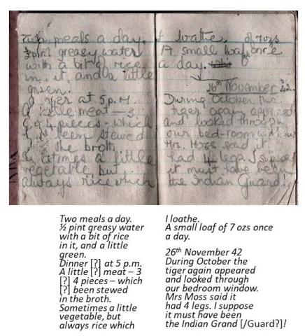
pages 9-10 cropped.jpg
1940s
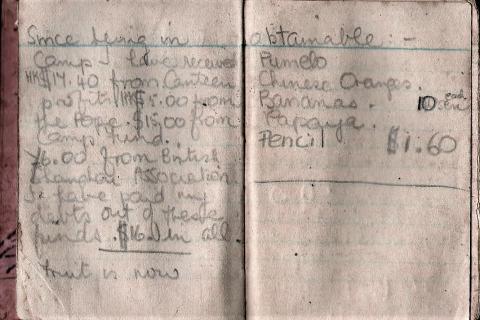
pages 11-12
1942
pages 3-4 cropped.jpg
1940s
pages 5-6 cropped.jpg
1940s
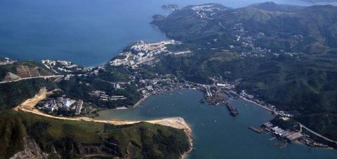
Aerial Photo overlooking Hang Hau and Port Shelter
1984
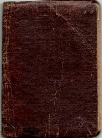
Diary - opening pages
1940s
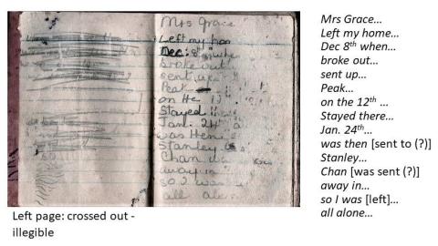
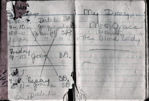
Grace Smith's Diary
1941
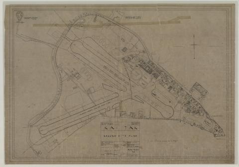
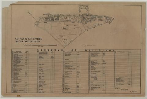
Kai Tak R.A.F Station Block Record Plan - 1966
1966
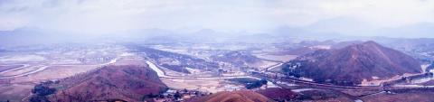
View of Lo Wu border crossing and Shenzhen, from Tai Shek Mo. Early 1971.
1971
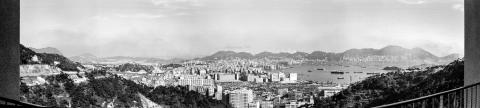
Panorama of Cheung Sha Wan, Sham Shui Po, West Kowloon and harbour. 1971.
1971
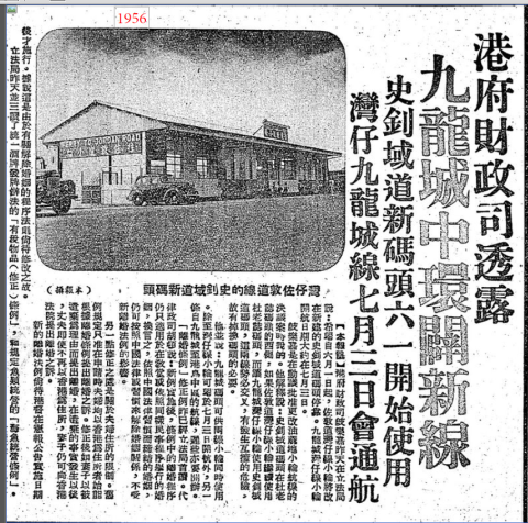
1956 stewart pier 2.png
1956
Pagination
First page
« First
Previous page
‹‹
…
Page
428
Page
429
Page
430
Page
431
Page
432
…
Next page
››
Last page
Last »