Skip to main content
Menu
Menu
Home
Free newsletter
Shop
Explore
Add new...
What's new
FAQs
About
Gwulo menu for header
Show — Gwulo menu for header
Hide — Gwulo menu for header
Home
What's new
Gwulo
Old Hong Kong
Photos by author: Herman
Year
Title
1926
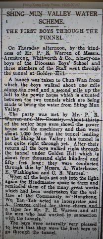
Hong Kong Daily Press 1926-07-17
1949
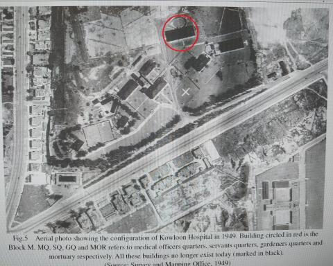
Kowloon Hospital aerial photo 1949
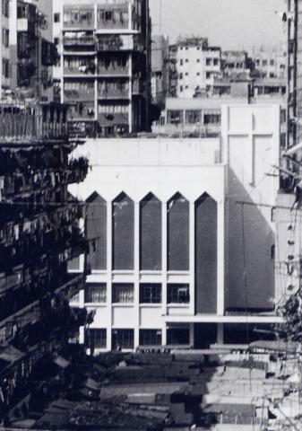
1962
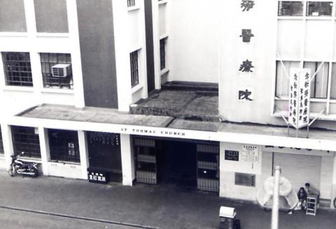
St thomas Church (2).jpg
1962
St Thomas church (3).jpg
1962
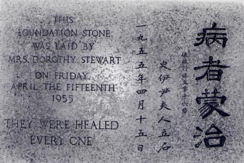
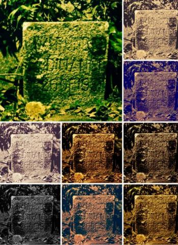
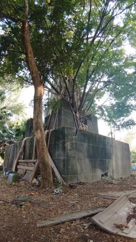
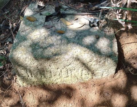
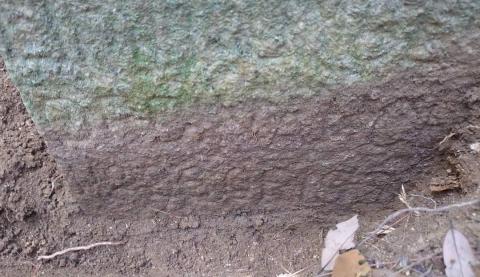
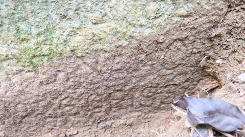
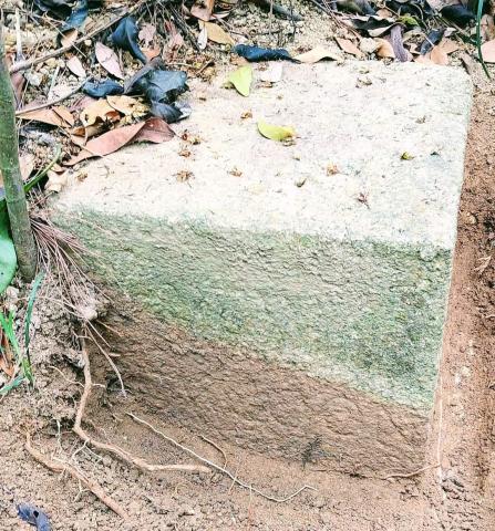
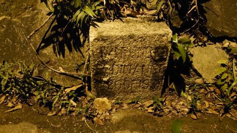
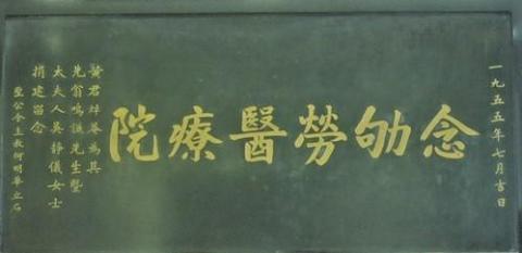
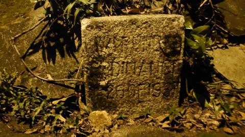
念劬勞醫療院奠基石 - foundation stone.jpg
1962
St thomas church.jpg
1969
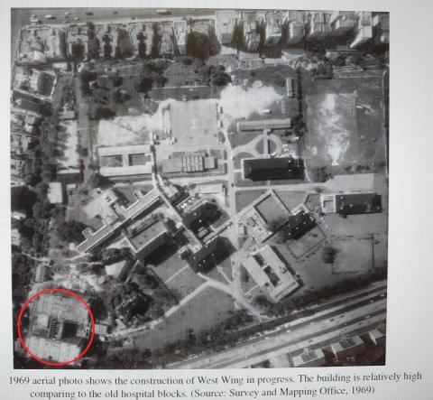
Kowloon aerial photo 1969 (Survey and Mapping Office)
1981
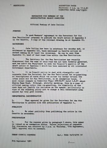
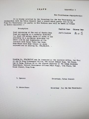
Document of JAT INCLINE naming
1981
DSC_3968~2.JPG
1981
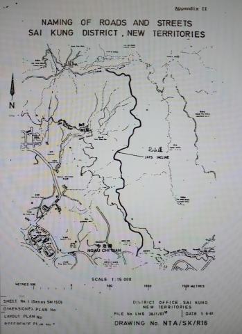
Naming of JAT INCLINE
1981
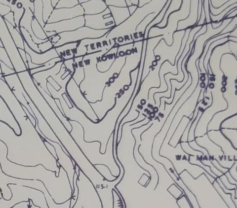
Map of JAT INCLINE
1981
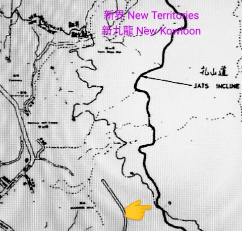
Map of JAT INCLINE (2)
2020
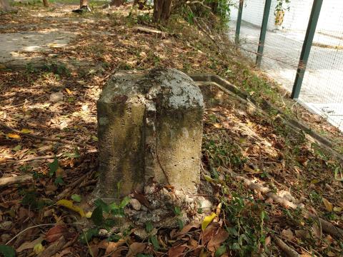
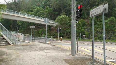
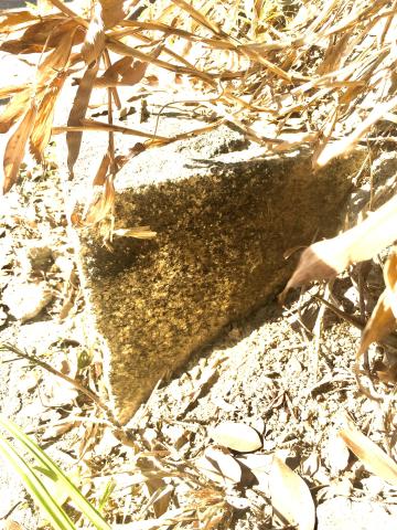
New Territories/New Kowloon boundary stone at JATS INCLINE
2020
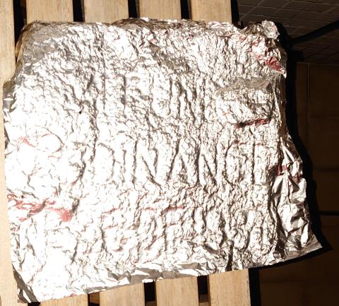
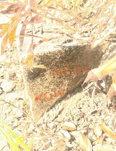
JAT INCLINE BOUNDARY STONE ENGRAVING
2020
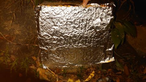
JAT INCLINCE BOUNDARY STONE ENGRAVING FOIL
2021
HK Observatory Signal Station (pole)
2021
HK Observatory Signal Station - Kowloon Hospital
2021
HK Observatory Signal Station (2)
2021
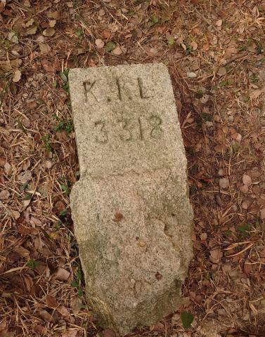
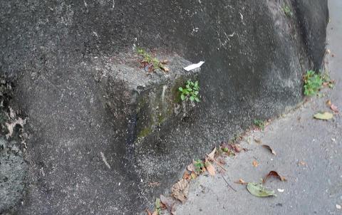
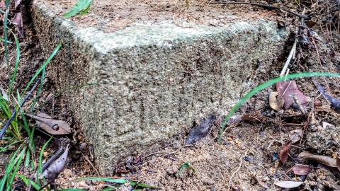
K.I.L. 3318 Marker Stone
2021
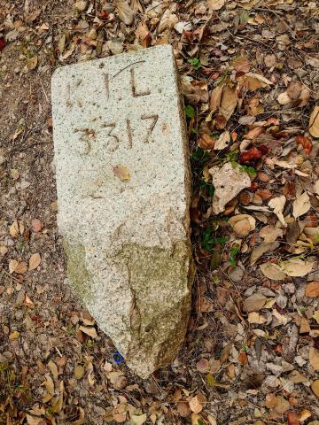
K.I.L. 3317 Marker Stone (photo taken 1/2021)
2021
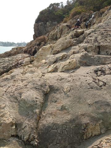
A.R.F. marking near Pillbox 29
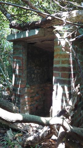
2021
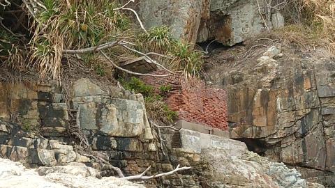
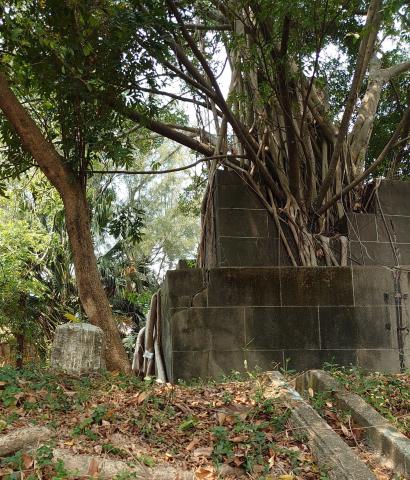
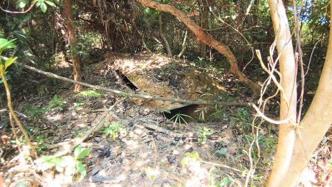
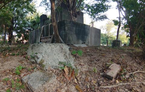
Red Brick Structure near Pillbox 29
2021
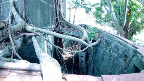
Ceiling of tower base from the SW corner
2021
Observatory Tower (west side)
2021
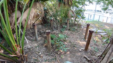
Vertical pipes
2021
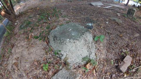
Concrete base (East view)
2021
Concrete base (South view)
2021
Concret base with a yellow leave on top as marker
2021
Signal Tower view from outside the fence
2021
Concrete base (top view)
2021
Concrete base (west view)
2021
Concrete base (North view)
2021
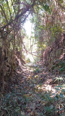
Foot/Drive path
2021
Brick structure with pebbles concrete on top
2021
Brick structure near Southeast side
2021
Dip with a cover?? on the ground, southeast side previous Cash’s Bungalow
2021
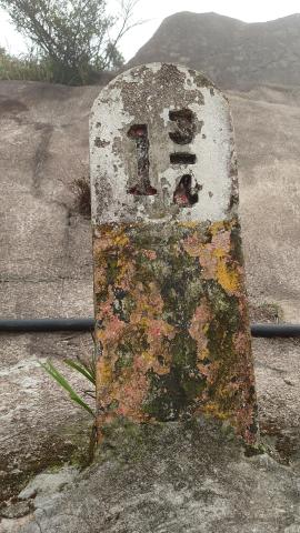
Tai Mo Shan Milestone 1 3_4.JPG
2021
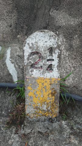
Tai Mo Shan Milestone 2 1_4.JPG
2021
Supporting Pillar at No.9 aqueduct of the Pok Fu Lam Conduit (1).JPG
2021
Supporting Pillar of No.9 aqueduct of the Pok Fu Lam Conduit (2).JPG
2021
Supporting Pillar of No.9 aqueduct of the Pok Fu Lam Conduit (3).JPG
2021
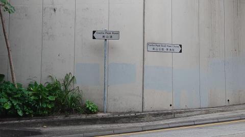
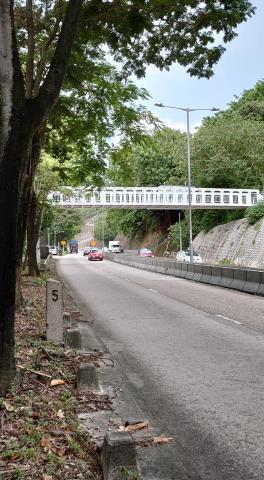
Castle Peak Road becomes Castle Peak Road - Kwai Chung
2021
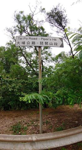
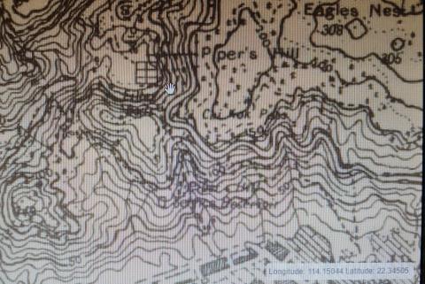
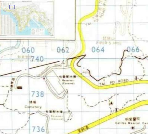
Tai Po Road - Piper's Hill
2021
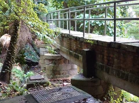
Tai Po Road Footbridge
2021
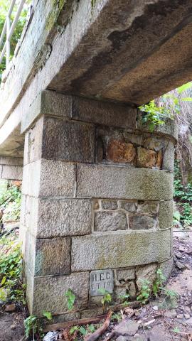
Castle Peak Road Footbridge (5-mile milestone)
2021
Map 1963 (Castle Peak road and Cheung Hang road)
2021
Mystery structure at Cheung Hang Road 2021-08-29 (closer look)
2021
Location of mystery structure at Cheung Hang Road
2021
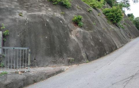
Cheung Hang Road
2021
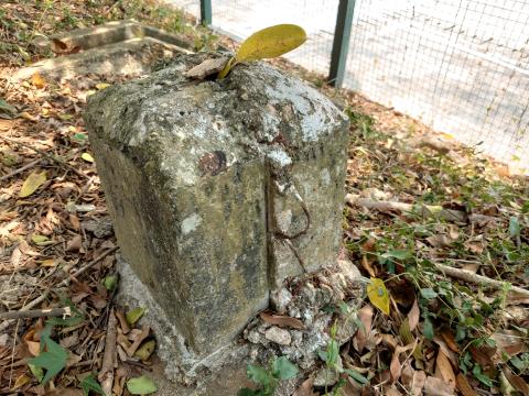
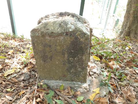
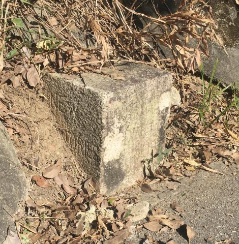
JAT Incline NT/NK boundary stone NT surface (a)
2021
JAT Incline NK/NT boundary stone (NT surface) (b)
2021
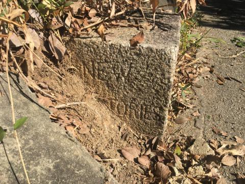
JAT incline NK/NT boundary stone (NK surface) (a)
2021
JAT incline NK/NT boundary stone (NK surface) (b) (Inscriptions able to be seen are colored with orange on screen)
2022
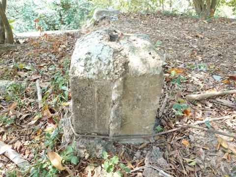
?? N.K./N.T. boundary stone near Beacon Hill (March 2022)
2022
N.K./N.T. boundary stone (Beacon Hill)
2022
N.K./N.T. boundary stone (Beacon Hill)
2022
N.K./N.T. boundary stone (Beacon Hill)
2022
N.K./N.T. boundary stone (Beacon Hill) N.K. Surface
2022
?? N.K./N.T. boundary stone (Beacon Hill)
2022
JAT Incline NK/NT boundary stone ( August 2020)
????
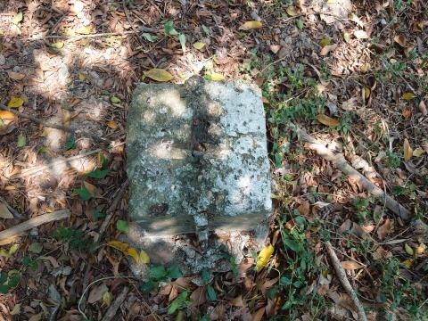
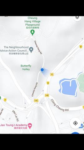
Location of NK/NT boundary stone - JATs incline
????
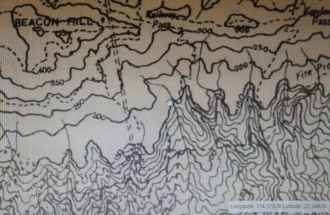
Location of NK/NT boundary stone - Beacon Hill
????
Location of NK/NT boundary stone - Caldecott road
????
Stair step and Pipes near Hong Kong Observatory Signal Tower at Kowloon Hospital
????
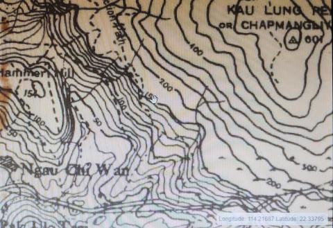
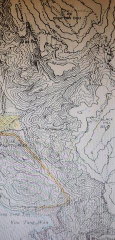
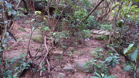
Passage intersections near 150m contour level a
????
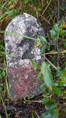
??Mystery stone near Beacon Hill (May 2 2020)
????
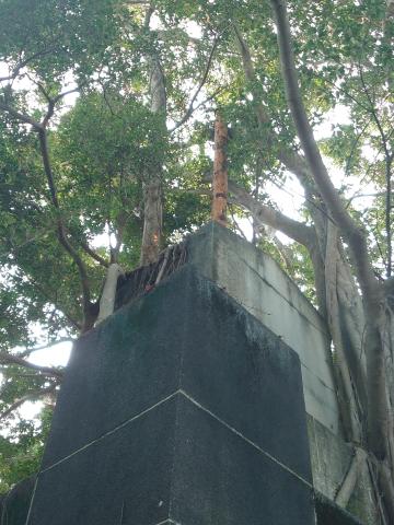
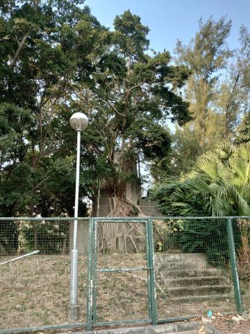
Hong Kong Observatory Signal Tower - Eastern view
????
Passage intersections near 150m contour level b
????
Hong Kong Observatory Signal Tower - Southwest view
????
Hong Kong Observatory Signal Tower - Southwest view
????
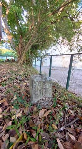
?? N.K./N.T. boundary stone near Beacon Hill
????
Granite stone along the footpath, towards uphill to Beacon Hill
????
念劬勞醫療院 Foundation stone.jpg
????
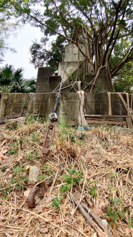
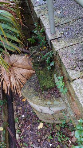
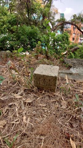
Lot Stone near NW corner of the Tower
????
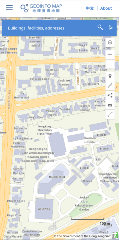
Geoinfo Map of Hong Kong Observatory Signal Tower
????
Concrete base (west view)
????
Tai Mo Shan Milestone 2.JPG
????
JAT incline NK/NT boundary stone (August 2020)
????
NK/NT boundary - Tai Po Road