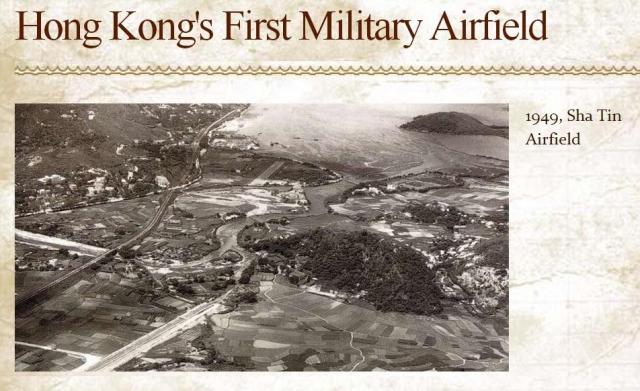
Aerial photo showing the downstream reach of the nullah where it flows into Sha Tin Hoi. The nullah, shown in the lower left of the photo, is not identified in the 1952 map 1949 Third Edition.
The photo also shows the runway, and is a good representaton of the area prior to urban development and reclamation.
Photo Source: uwants.com - post #2252 by user 4 rex - http://www.uwants.com/viewthread.php?tid=14833421&page=151#pid216112868
Date picture taken
unknown
Shows place(s)
Comments
Re: Hong Kong's First Military Airfield
Nice photo of Sha Tin and the former airstrip. The post about Hong Kong's first military airfield being at Sha Tin is from the Hong Kong's First blog. Well before civil aviation, Kai Tak had been a military airfield. Thereafter, a landing field was constructed at Pat Heung in 1938.