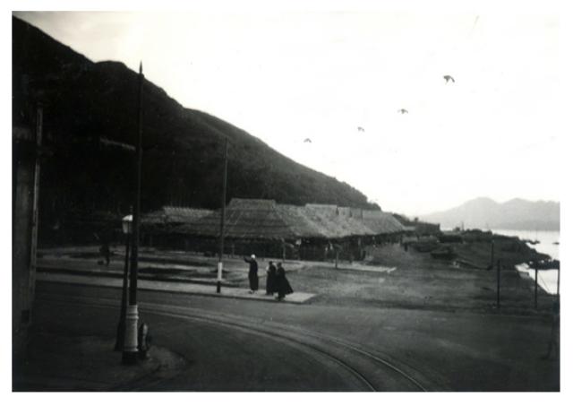
The title is taken from the photo om Flickr. I'm not sure how long a market stood there - today it's the site of a small, grassy park.
It's not clear where the seafront to our right stood either in this photo. When the tramline was built, it ran along the seafront [Update - that's not true, see comments below]. Later another block was reclaimed to the North (a very modest reclamation by HK standards!) to make the 'Kennedy Town New Praya' the new and still current sea-front.
Kennedy Town New Praya exists on a 1958 map, but was it there in the 1930s?
Source: This image came from Flickr, see https://flickr.com/photo.gne?id=4158939572
Date picture taken
1930s
Gallery
Shows place(s)
Comments
Re: Kennedy Town Fruit Market
In the 1930s photo, the people standing on the 'island' in the centre of the street is where the Kennedy Town Tram Terminus used to be. To the immediate right of the photo along Catchick St would have been godowns (warehouses) and boats would be tied up along the waterfront loading/unloading their goods. In this part of Kennedy Town, the trams have always run 'inland' between Cadogan St and Smithfield Rd.
Here is a map of the area from the 1920s showing the waterfront and tramline.
1900s Kennedy Town looking east along Catchick St with godowns on the left along the waterfront.
Re: Kennedy Town Fruit Market
I've made that mistake before - assuming that all the tram line ran along seafront originally. Thanks for the correction, and the extra photos.
2010s Junction of Cadogan and Catchick Streets
Taken from Le Merton