Cottage Resettlement Area is a type of single-storey temporary housing built by various charitable organizations and taken over by the Resettlement Office (the predecessor of the Hong Kong Housing Authority). It is the early public housing in Hong Kong .
history
The bungalow area was originally permitted to be built on the relevant land in accordance with the approved plan in 1952 under the Emergency (Resettlement Areas) Regulations under the Emergency Regulations Ordinance. Structures are provided for qualified residents to live in. After the residents pay a specified fee, the Municipal Council issues a residence permit commonly known as a "white card" to authorize them to build structures on the land. However, the residents do not own the structures. Under the land title, residents need to pay a quarterly residence permit fee commonly known as "land tax".
In 1958, one of the items of the Resettlement Ordinance was enacted to replace the Emergency (Resettlement Areas) Regulations. The Resettlement Ordinance was later repealed by the Housing Ordinance in 1973, and the new Ordinance empowered The Housing Authority has the power to manage these bungalow areas and enforce the tenancy conditions of the residence licences. With the development of social and public housing, bungalow areas were gradually demolished. In the 1997 Policy Address, the Hong Kong government promised to demolish the remaining five bungalow areas by the end of 2001.
https://zh.wikipedia.org/zh-tw/%E9%A6%99%E6%B8%AF%E5%B9%B3%E6%88%BF%E5%…
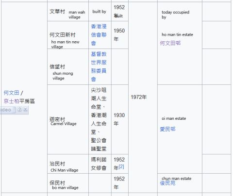
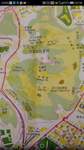
One was in Kings Park called Kings park Cottage Resettlement Area
The area included approximately today's Ho Man Tin estate, Oi Man estate and Chun Man estate
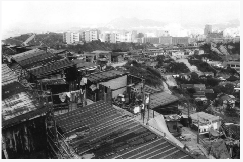
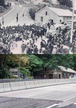
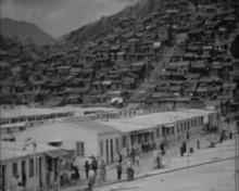
This photo shows the Kings park Cottage Resettlement Area in 1966. Looking west. It was a mixture of legal single-storey housing units and illegal squatter huts
This 1962 picture shows the cottages on both sides of Nairn rd ( Princess Margaret Road). With Pui Ching school on the top right corner. The photo is looking south. The cemetery north of Pui Ching should be the mohammedan cemetery in the maps below.
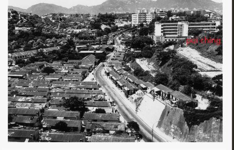
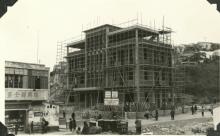
Block E of Pui Ching school completed in 1953.
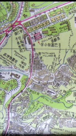
1950s maps showing kings park cottage resettlement area
Photos that show this Place
Comments
1960s ho man tin new village
1960s ho man tin new village close to the nairn rd-Pui ching rd junction. Likely south of the junction looking north.
People are getting water from public taps. Behind the cottages on the right were steps going up to the Lock Tao school shown in this map.
aerial view of Kowloon in 1965
An extensive area of Ho man tin area was scattered with these cottages in the 1960s as seen in this 1963 aerial map.