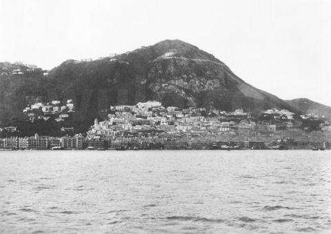
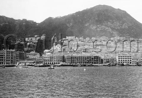
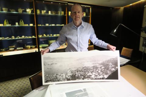
Where: Hong Kong island as seen from the harbour. I've been tidying up this photo to use it in my next talk in November. One sequence looks at how this view has changed over the years, with the new photo following a similar view from 1906:
What: So what did change? Let's start at the top and work our way down:
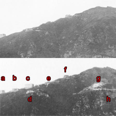
The most obvious change is the new house (g) and road (h), right in the middle of what used to be a barren hillside.
The house is number 27, Lugard Road [1]. It's been in the news recently, with arguments over whether or not it can be converted into a boutique hotel.
Then the new road is obviously Lugard Road [2]. Though we can't tell from the photos, it was built in two stages, several years apart. The first section was easy enough, as it could be cut into the hillside. It started near the Peak Tram terminus, ran as far as number 27, and was finished in 1914.
The next section was more difficult to build as the hillside was much steeper. Here the road had to be built on raised columns - you can see them on the right of the photo. Construction lasted from 1919 til 1921.
Further down the slope there have been changes too:
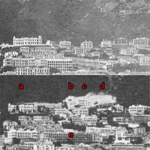
The grand building at top-left (a) was Sir Paul Chater's residence, Marble Hall [3]. In the older photo, his was just about the highest plot in mid-levels, but in the second photo another plot (b, c, d) has been carved out of the hillside above him. Looking at a modern map of the area, that was the last time they managed to find any higher building plots in mid-levels. From there up to Lugard Road the the hillside is just too steep to build on.
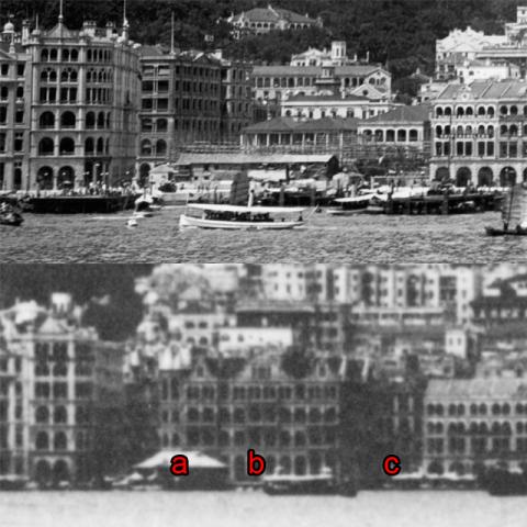
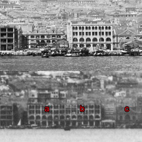
Chater had a clear view out over Central to the harbour. From his window he'd have been able to follow the progress of his most visible project, the Praya Reclamation [4]. By 1906 the reclamation was complete, but as these photos show it would take over twenty years before all the new land was built on.
This shows the seafront near the junction with Pedder Street. Blake Pier (a) [5] is visible in both, but the early photo shows it before it got a roof. To the right of the pier, the early photo shows a construction site, with bamboo scaffolding in place. They were building the new General Post Office [6], finished in 1911 and visible in the later photo (b). However the next plot (c) is empty in both. Eventually the P&O building [7] will be built there.
Further west, the early photo shows a new building (b) on the reclamation, with empty plots on either side. In the second photo the building has been extended left to fill the whole block from Pottinger Street to Queen Victoria Street. The plot on the right is still empty though, giving us a view through to Central Market [8] on Des Voeux Road. Eventually this plot will be the site of the new Central Fire Station [9].
When: We know that Lugard Road was finished in 1921, so the new photo can't have been taken before that.
But there's no sign of Central Fire Station (completed 1926) or the P&O Building (completed 1924), so it must have been taken some time in the years 1921-23. I'll guess 1922 for now, but corrections are welcome!
|
Also on Gwulo.com this week:
|
References:
- 27, Lugard Road
- Lugard Road
- Marble Hall
- Praya Reclamation
- Blake Pier
- General Post Office
- P&O Building
- Central Market
- Central Fire Station
This photo reference: EE058
