Since the first article on the tunnels under Kowloon Park, we’ve only looked at tunnels on Hong Kong island. So, time to head back to Kowloon side, and look at networks K4 and K5 near Hung Hom. I’ve marked their locations on the Google satellite picture below, along with the other networks in Kowloon.

Why are there so few tunnels in Kowloon compared with Hong Kong island? The satellite photo shows large areas of housing with no access to a tunnel.
Here’s another view, this time using a picture of Kowloon taken in 1944 by a US airplane [from book "Mapping Hong Kong", publ. HKGIS] (note the white area in the top right corner – it's the early Kai Tak airport).

It’s striking how much of Kowloon was still free of any buildings at that time. Maybe that explains the difference, that there were simply fewer people living in Kowloon than on the island? The government’s population estimate in 1939 showed 460,190 people living on the island, vs. 378,167 people living in Kowloon. So yes, there were less people in Kowloon (about 80%) than lived on the island, but there were much less than 80% of the island's tunnels in Kowloon, so it still doesn’t really explain the difference.
Maybe a simpler explanation is the lack of suitable ground to dig tunnels in. Most built-up areas in Hong Kong are near to a steep hillside, suitable for excavating tunnels in. Kowloon is much flatter. Built-up areas like Sham Shui Po that weren’t close to a steep hillside may have been given the shelters built from concrete blocks instead, like the one shown in this picture.
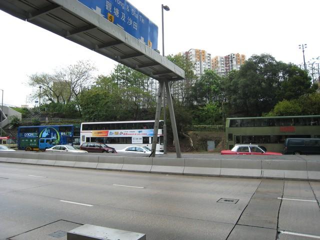
Back to today’s tunnels. You’ll have passed them if you’ve ever driven along Chatham Road in the Hung Hom area – it's the road from the Cross Harbour Tunnel to the old airport. There’s not much evidence to see of the southern K4 ‘Chatham Road’ network. It was originally tunneled under what must have been a large hill. However several sections of tunnel and most of the portals were removed in the late 1970s, during excavations for the ‘Wuhu Interchange of the Western approach to the airport’. If you’re driving along Chatham Rd from the Cross Harbour Tunnel, the K4 tunnel is on your right just before you pass under the Fat Kwong St bridge.
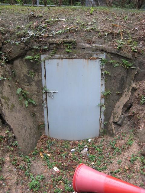
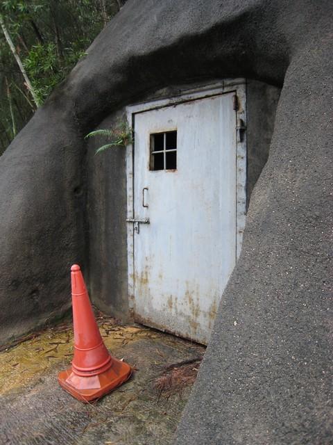
Here’s a photo taken from across Chatham Rd. The blue bus on the left is at a bus stop. There used to be a portal in the hillside where the bus stop is, but there’s no sign of it now. A little further along the road is the grey door that marks the one remaining portal. You can see it just to the left of the red taxi in the photo below.
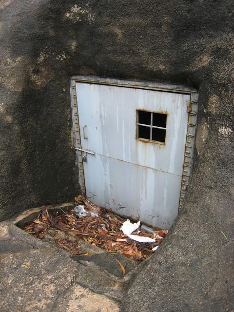
Here’s a close-up of the door. Note the curve of the concrete tunnel roof over the doorway.
If you look back to the 1944 photo, the area to the south-east of the tunnel was the old ‘Hong Kong and Whampoa’ dockyards. I guess these tunnels were meant to serve some of the workers from the dockyard?
I had thought that the tunnels were probably used briefly, if at all, during the invasion in 1941 as Kowloon quickly fell to the Japanese. However the WikiPedia article on the docks states “In the eve of Japanese occupation of Hong Kong, due to its importance, the dockyard was heavily bombarded by Japanese aircraft with large casualties.”
The tunnels were probably used again during the occupation as the dockyards were frequently targeted by allied bombers. Here’s the earliest bombing raid I can find mentioned, on 25 October 1942:
CHINA AIR TASK FORCE (CATF): 12 B-25s and 7 P-40s, led by Colonel Merian C Cooper, hit Kowloon Docks at Hong Kong; 21 aircraft intercept; 1 B-25 and 1 P-40 are shot down; this marks the first loss of a CATF B-25 in combat; the Japanese interceptors are virtually annihilated; during the night of 25/26 Oct 6 B-25s, on the first CATF night strike, continue pounding Hong Kong, bombing the North Point power plant which provides electricity for the shipyards;
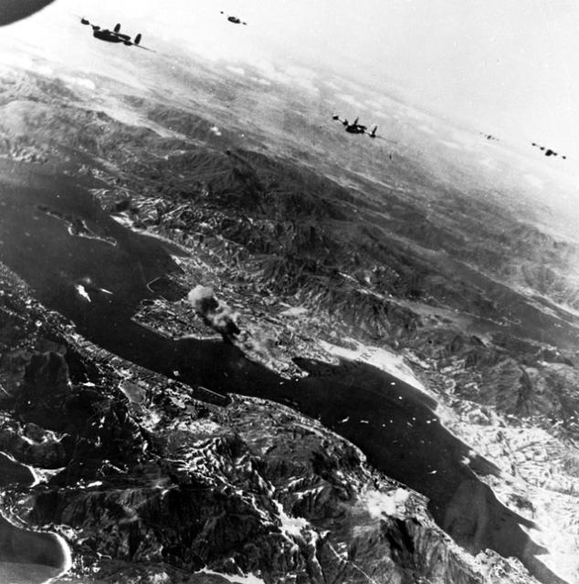
After that there are many more, including this one on 16th October 1944:
(Fourteenth Air Force): In China, 28 B-24s, 8 B-25s, 26 P-51s, and 21 P-40s blast shipping and the Kowloon Dock area of Hong Kong; 15 cargo vessels are damaged or sunk;
That’s worth a mention because the HK Public Library collection has photos of the attack, showing smoke rising from the dockyards.
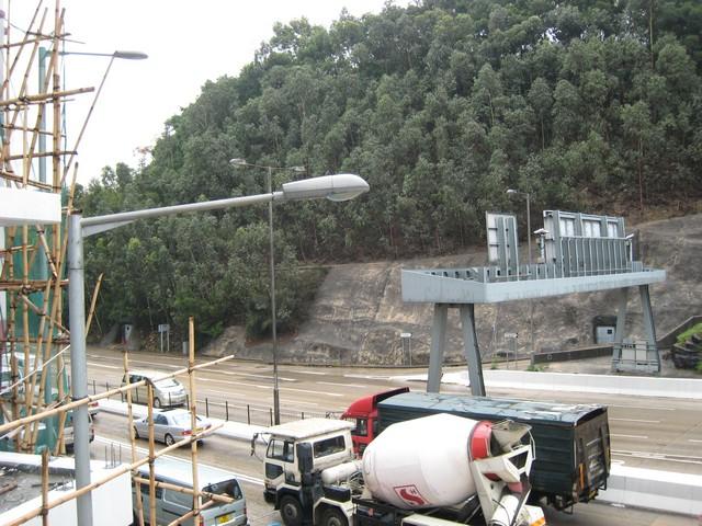
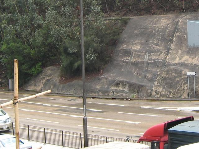
Next we look at the K5 tunnel network on the north side of Chatham Rd. Here the hillside rises higher and more steeply than it does above the K4 network. In general, the networks where tunnels were dug into deep rock have survived in much better condition than those closer to the surface. Despite that, these tunnels are in a very poor condition. There was a fierce oil fire in these tunnels during the Japanese occupation, which severely damaged the tunnel linings.
Here’s the view from the pedestrian bridge at Wuhu Street, looking North across Chatham Rd. You can see two grey metal doors in the photo. The one on the right is portal #4, while the one on the far left is portal #1. Both these doors are set further back than the original portals, which were removed when Chatham Road was widened.
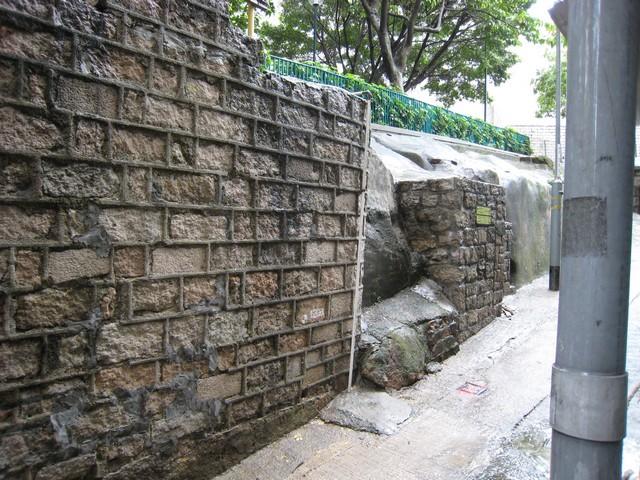
The tunnels that led to portals #2 and #3 have simply been blocked off, but if you look carefully at the picture above, you can see where the curved concrete lintels mark their presence. Here's a magnified copy to make it clearer.
There’s no sign of portal #5. In the alley between Valley Rd and Yan Fung St there’s a small brickwork construction about where portal #6 should have been, but whether it is the portal or not I can’t be sure.
Here’s portal #1.
Both doors on this network they have large openings for ventilation, which lets us take a look inside.
Not very inviting!
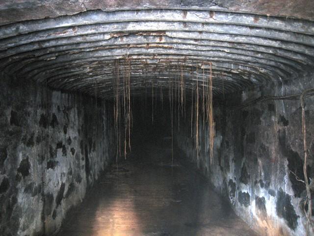
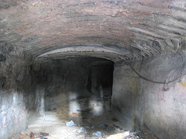
Here’s portal #4,
and the view inside. You can see the bend in the tunnel, as shown on the map.
I didn’t have a chance to see if portal #7 or the ventilation shaft are still visible – something to save for drier weather.
MrB
Comments
Hi there,
I happen to be on a bus thinking of when would you folks bring out the topic of the ARP tunnels on the Kowloon side..... :-P
As for Portal 5, I was wondering...... I was on the top deck of a Route 215X double-decker running east-bound. When the bus went past Yan Fung Street (The one up-slope street next to portal 4 and just next and under to the foot bridge), I saw a slope/wall with a frame that looked like something is behind it. That might be it and I think you should be able to see it while you are on the foot bridge, looking toward the northern end of the bridge itself.
T
T followed up his message with this photo:

T, I think you're right. I'll put up a map on the next message, and it shows Portal #5 right at the same spot as your photo. Not sure how I missed that, so a big thankyou for your help.
I happen to be on a bus thinking of when would you folks bring out the topic of the ARP tunnels on the Kowloon side..... :-P
Batgung is trialling some new telepathic blogging methods, where we answer readers' questions before they ask them ;-)
Cheers, MrB
Hi there,
I guess before they constructed Yan Fung Street the portals were pretty much along Chatham on a fairly straight line. That section of east-bound Chatham Road had not changed much in the past few decades anyway.
Looked like urban development there had destroyed most of the traces of the portals. I wonder if there are still traces alone Fat Kwong Street.......
T
Comments
Re: Chatham Road ARP Tunnels
Hi there,
Owing to the extension of the MTR Kwun Tong Line, this whole slope is now gone together with the ARP tunnels.
Best Regards,
T