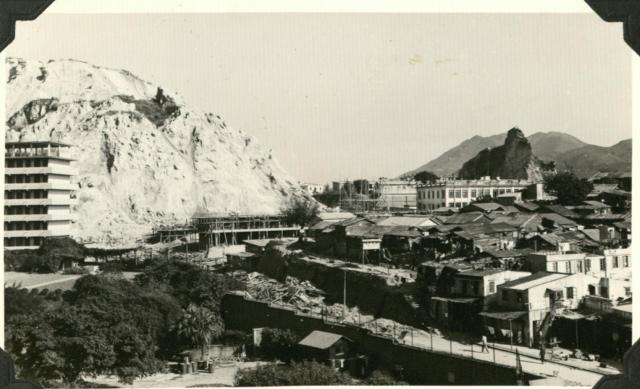
Tai wan shan 1956 showing tai wan hill and block D of "new Hunghom Cheun" completed in 1956, as distinguished from "Hunghom Cheun" built around the same time at the ma tau wai-station lane junction. (https://gwulo.com/atom/41027). It was usually called the "Tai Wan Shan cheun". Today it was replaced by an estate called "Whampoa estate" built in 1999 and 2011.
Block D was the closest one to the hill on its west side. The photo was looking east. One can see the strange hill with a pointed top and the Whampoa dock staff quatters Highburgh Terrace and Inverness Terrace close to that hill.
https://gwulo.com/node/41199#15/22.3056/114.1903/Map_by_ESRI-Markers/100
What is interesting is the squatter huts area opposite block D south of Dyer street. In a 1973 photo, that part was occupied by two relatively new Whampoa dock staff quarters williamson terrace and havelock terrace
====================================================================
================================================================
As a matter of fact, those new quarters were already there in a 1960 map

==============================================================
Comments
tai wan shan squatter huts 1956
Another view of squatter huts around Tai wan shan in 1956. People there were waiting to move in to the Tai Wan Shan estate which was close to completion. One can see one of the blocks of that estate in the background.