There does seem to be quite a similarity between the area shown on this map and the view on the 1958 slide. I can now see why you referred to a school building as one is clearly shown on this map, and the configuration of it and the row of buildings on the foreshore would fit reasonbably well with those on the flipped version of the slide. Sam Mun Tsai would also have been a more accessible place in the late 1950s. Any thoughts anyone?
Comments
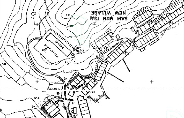
There does seem to be quite a
There does seem to be quite a similarity between the area shown on this map and the view on the 1958 slide. I can now see why you referred to a school building as one is clearly shown on this map, and the configuration of it and the row of buildings on the foreshore would fit reasonbably well with those on the flipped version of the slide. Sam Mun Tsai would also have been a more accessible place in the late 1950s. Any thoughts anyone?