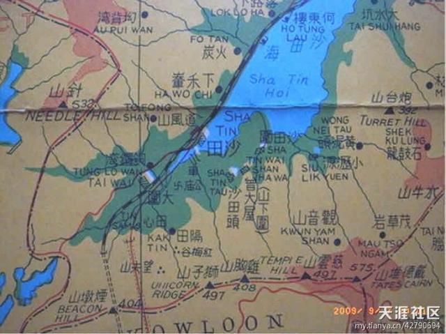
Shatin - early period map showing land and water prior to start of major urban development and land reclamation. The date of this map is estimated to be 1950s.
Note that Fo Tan and the train track were at one time located next to the Sha Tin Hoi (Shatin Sea). The present Shing Mun River now flows by them, and by large has functionally replaced the original nullah.
Photo source: http://bbs.tianya.cn/post-208-14649-37.shtml
Date picture taken
unknown