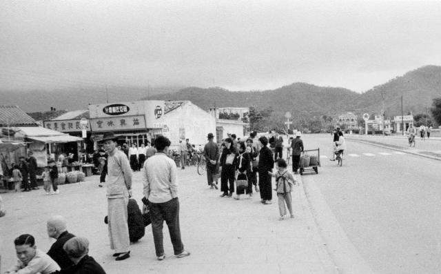
Pak Shing street looking towards the river from the market. It's Changed but is still recognisable after nearly 60 years.

Even though I was more or less on the same spot, I couldn't get an exact match. Perhaps the alignment of the road has changed.
Date picture taken
1958
Gallery
Shows place(s)
Comments
Sharing a photo from Facebook
Sharing a photo from Facebook, showing the same place
Road alignment
Andrew, the road alignment did indeed change when they removed the road bridge crossing and installed a new pedestrianized bridge.
Phil. Do you think this
Phil. Do you think this photogaph was taken before or after mine of 1957/8?
Tai Po
It's difficult to say but my guess would be the small white hut in the background of terewong's image was probably a later addition. Coincidentally, the govt are currently intending to reinstall the road crossing here and do away with the pedestrianised bridge: https://transitjam.com/2020/07/13/lawmakers-quiz-officials-on-tai-po-ro…
1957 was actually the year the granite version of the bridge was opened, so I think you have captured it when it was still fairly new. The far right of your image shows the granite balustrade which was later remodelled into pathway for the current pedestrianised version.
Memory can play tricks,
Memory can play tricks, especially after so many years since I took the original photo in 1957/8. I have been wrong on a few occasions and now I am intrigued by these images. When I took the colour photo in 2005 I thought that I was standing more or less on the same spot as for the 1957/8 one, i.e. in the open area in front of what had been the covered market, but I wonder whether I was further to the North. In my gallery there is another photo showing the covered market that was taken on the same occasion in 1957/8. Now, on Google Earth, the distance to the river does not seem to be as great as on either mine or terewong's photo, and there certainly does not seem to be enough room for the filling station and more to have been there in the 1950s. Has the course of the river been changed? Any comments?
bridge
I think you have the location of your old image more or less correct. However, even though it is looking the same way, the image posted by terewong appears to have been taken on the opposite bank, or at least most of the way there. The buildings on the left of that image are not the same as those on yours, but were actually on the opposite side of the river. Also the railings show where the split started on the bridge between pedestrians and cars (on the opposite side). Funnily enough, like many other petrol stations in HK, the location in the background still contains several petrol stations.